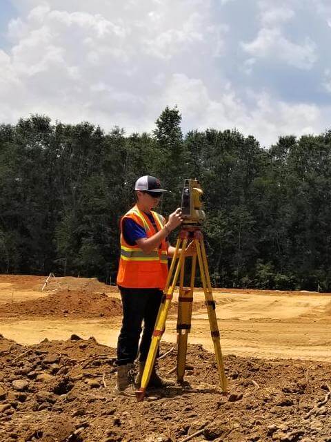
Land Surveyor in Central Alabama
Professional
Land Surveying
and Mapping
We are a full-service, field-to-finish surveying firm, based in Clanton, Al. We provide surveying services to public agencies, engineering firms, private contractors, architects, and homeowners throughout the central Alabama region.
Our surveying services
cover the entire state of Alabama
We are locally and family owned land surveying company. A fully licensed and insured land surveyor will survey your property. When you call our phone number (205) 688-6656, you will talk to directly to a qualified land surveyor.
We strive to provide the highest quality service, while completing jobs on time and within budget.
Randy began surveying when he was 14 years old. At the start of his career, he surveyed for Jordan Jones & Goulding in Atlanta, GA. He was with them for 10 years. His next employer was Howell Engineering in Birmingham, AL for 6 years. Randy continued gaining experience as a surveyor working for Robinson Paving in Columbus, GA for 5 yeas, ARD Contracting in Birmingham, AL for 3 years, and Arrington Engineering & Surveying in Hoover, AL for 6 years.
To get a consultation about an upcoming project that may need our services, call us at (205) 688-6656.
Our surveying Areas

Residential Surveying
Boundary Surveys, Lot Split Surveys, Property Line Stacking and much more.

Commercial Surveying
Aerial Surveys, ALTA, Toopographic Surveys, Site Plans and much more.

Boundary Survey
We will determine your property lines and property corners.
Our surveying services
ALTA Surveys
Boundary Survey
Foundation Surveys
Site Plan
Topographic Surveys
As-Built Survey
Our Work
Take a look at some of our surveying jobs


Drones For Modern Surveying
Check our list of drone services below:

Orthomosaic Pictures
3D Models
Topographic Surveys
Asphalt & Parking Lot Surveys
Damage Assesment Surveys
Rooftop Surveys
Agricultural Surveys
Coal Mine Surveys
Quarry Surveys
Route Surveying
Oil Fields Surveying
Urban Planning
What people
are saying