Affordable and Reliable Boundary Survey
What is Boundary Survey?
A boundary survey is performed to determine property lines and property corners of a certain parcel of land as described in a property deed. Boundary surveys are the most common surveys requested and performed in Alabama. Although this basic survey is usually required by a title insurance company or a mortgage company, individuals may request a boundary survey on their own. If a property has been in a family a long time, chances are it has not been surveyed or has an inaccurate survey. Parent property owners have their land surveyed to deed property to their children. Family or joint land owners hire surveyors to the division of property or an estate. Potential sellers request a boundary survey to determine the actual size and more accurate worth of their property. Buyers of property may request a boundary survey to know exactly what they are buying. Investors need boundary surveys to subdivide property. The seller, buyer, or real estate agent may not know the true property lines. For the buyer, seller, inheritor, investor, title company, lender or any other vested party, a boundary survey will provide a detailed document to make informed decisions.
If a property owner suspects a neighbor is encroaching (intruding) on their land or the neighbor is accusing you of encroachment, a boundary survey is needed. Disputes may arise with utility companies or government agencies about rights to be on or cross your land (easement) may be settled with a boundary survey.
A boundary survey is usually requested for selling, buying, dividing, improving, or constructing structures of and on a parcel of land. It may prevent costly problems down the line. A property owner may have to move or demolish a structure or remove a fence if it was built over the property line. The boundary survey will help to settle current disputes with those that believe they can legally enter or cross the property owner’s land.
How does it work
After a request is made for a boundary survey from a client, our professional team begins to research the property. A deed for the parcel and surrounding parcels is pulled from the local courthouse or from online if available. The title, legal description, and any other available information about the property is carefully examined.
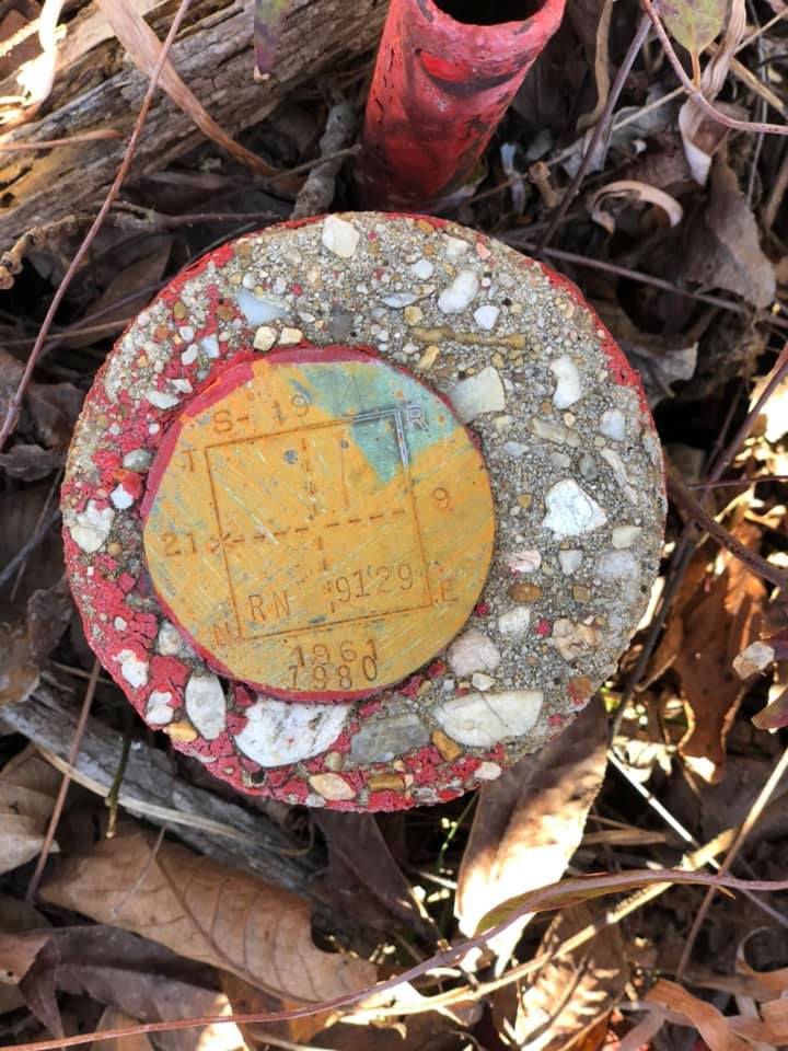
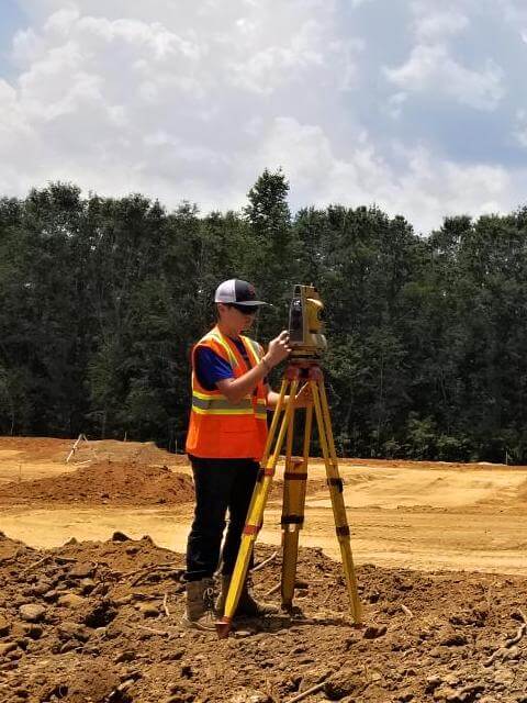
The next step is to physically go to the property (out in the field). Our team looks for any evidence of the corners of the property such as metal stakes, rebar, iron pipes, crosses, or cotton spindles (also known as monuments). There may not be any evidence of the corners, because this might be the first survey, the markers may be lost or may not visible. Measurements are taken to evaluate pre-existing corner markers for accuracy or to determine placement of new markers. If the corner markers are not located, we install new ones. They are placed at every corner including any angles or deviations of the boundary lines. The corners are marked using a metal rod, such as rebar, driven vertically in the ground at each corner. We attach a surveyor's cap (a metal or plastic top) to the rebar with our license number printed on it.
The last step in this orderly process is combining the information gleaned from the deed (data) and the physical survey (evidence). The survey is our professional opinion on the physical location of our client’s property boundaries (corners and lines). We draw a map and develop the legal description of the property. The client will receive the boundary survey document via email and also a printed copy.
Boundary Survey Shows
In the field
- Marked property corners
Drawings
- Property corners
- Property lines
- Distance of any buildings or structures away from property lines
- All the improvements/changes from last deed description – buildings, any structures, fences, driveways.


