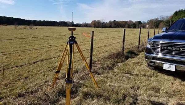
Topographic Surveys
Elevations, contours and features – the starting point for engineers and architects.
Learn moreFEMA Elevation Certificate
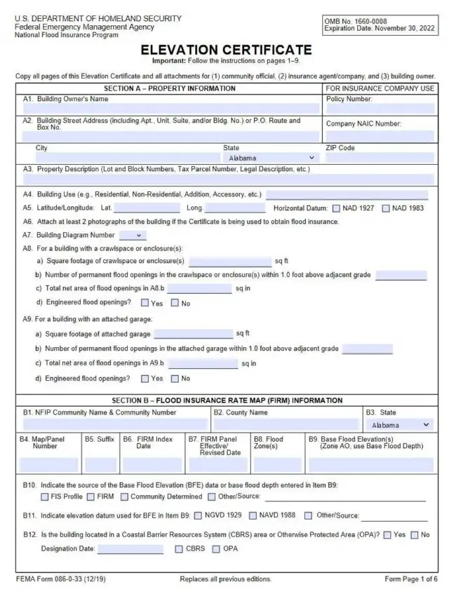
An Elevation Certificate shows your building’s elevation – how high it sits above a reference point. It matters if you are near a creek, river or lake, and it is the key to challenging a flood zone or lowering a flood insurance premium.
Why it matters
FEMA has established flood zones from historical data and updates them as needed – often after a storm or new development. If your property ends up in a Special Flood Hazard Area (a 1% or greater chance of flooding in any given year – the “100-year floodplain”), flood insurance becomes mandatory for a federally backed mortgage.
An Elevation Certificate from a licensed surveyor is needed to dispute that decision, to challenge an outdated flood status or to rate your flood insurance on your building’s actual elevation.
Try the slider – illustration only, not a flood study.
The process
The process may take time – and more time for the insurance company to implement the changes – so don’t delay if you need a flood study.
We survey your building and complete the technical documents. Our part of a flood study usually takes 3 days.
You request an official determination of your house and its elevation relative to the Special Flood Hazard Area.
FEMA reviews the map change request and issues a Determination Document with its final decision.
If approved, ask your lender to remove the mandatory federal flood insurance requirement.
Good to know
Central Alabama has plenty of water: the Coosa River lakes – Lake Mitchell and Lay Lake – on the edge of Chilton County, the Cahaba River and its creeks in Shelby and Jefferson counties, Autauga Creek in Prattville and the Alabama River past Prattville, Montgomery and Selma. Homes near any of them can be mapped into a flood zone, sometimes even when the house itself sits well above the water.
That is exactly when an Elevation Certificate pays off. It records the elevations of your lowest floor, the adjacent ground and equipment such as air conditioners, measured by a licensed surveyor and tied to the flood map datum. Insurance agents use it to rate a flood policy; FEMA uses it to review a Letter of Map Amendment request when a building is higher than the base flood elevation.
We work around Jefferson, Shelby and Chilton counties and throughout Alabama. Call Randy with your address – he can usually tell you on the phone what your situation needs.
I recently was fortunate enough to have the opportunity to purchase some family property. During the process, however, I found out that the property had undergone several confusing surveys over about 100 years, intermixed with property descriptions that had nothing to do with the property I was purchasing, was in FEMA flood zone X, and had a historical cemetery belonging to one of the state historical societies…
Randy was quick and efficient. Even when he had to make a 2nd trip (becaue I didn't communicate correctly, lol) he did so. He gave me a fair price and they allowed me to communicate through text ..which I preferred. I highly recommend them!
Randy with Alabama Surveying and Mapping was great to work with! As a Realtor I deal with surveys and surveyors all the time and I was impressed with how responsive he was to all the questions we had. We needed a unique property surveyed and split into two parcels and he did a great job very quickly, when no one else could, and got it done exactly how my client wanted! He's got our business and you should give him…
I am a Realtor and was frantically searching for surveyor near Clanton, AL on a Monday afternoon. The lender needed a survey asap and closing was set for Friday! I spoke with Randy Phillips with Alabama Surveying and Mapping; he was very understanding and professional. He went out of his way to help us with this issue. He was at the subject home by Tues morning in the rain and had the report to us by mid day!!! His…
Great experience. I deal with residential surveyors on a regular basis, but when I purchased a tract of land, Randy was recommended by the bank, and turned out to be very responsive, was able to do the job on a very tight schedule, and for a very reasonable price. I highly recommend him for any surveying you need.
Randy Phillips went over and beyond to survey my land in Jefferson County! Awesome company that is reliable, professional, and dependable. Any issues were quickly and professionally resolved. I highly recommend him and his company for any survey needs.
Questions & answers
Our part of a flood study – the field survey and the completed Elevation Certificate – usually takes about 3 days. FEMA’s review and your insurance company’s changes take longer, so start early.
It can. If your lowest floor is above the base flood elevation, the certificate can support a lower premium or a request to FEMA to remove the building from the Special Flood Hazard Area. If it is below, you will at least know your real risk.
Call us. We survey the building and complete the certificate; with it you can apply to FEMA for an official determination and, if approved, ask your lender to drop the mandatory flood insurance requirement.
Usually not for the outside measurements. We may need access to photograph and measure the lowest floor, a crawl space or an attached garage – we will arrange it with you.
Related
Elevations, contours and features – the starting point for engineers and architects.
Learn more
We determine your property lines and corners exactly as described in your deed.
Learn more
Documents what was actually built – during construction and for the Certificate of Occupancy.
Learn moreContact
When you call, you talk directly to a qualified land surveyor.