Perry County, AL
Boundary Survey on National Forest Land
- Service
- Boundary Survey
- Location
- Perry County, AL
- Year
- 2020
- Surveyor
- Randy Phillips, PLS
Project summary
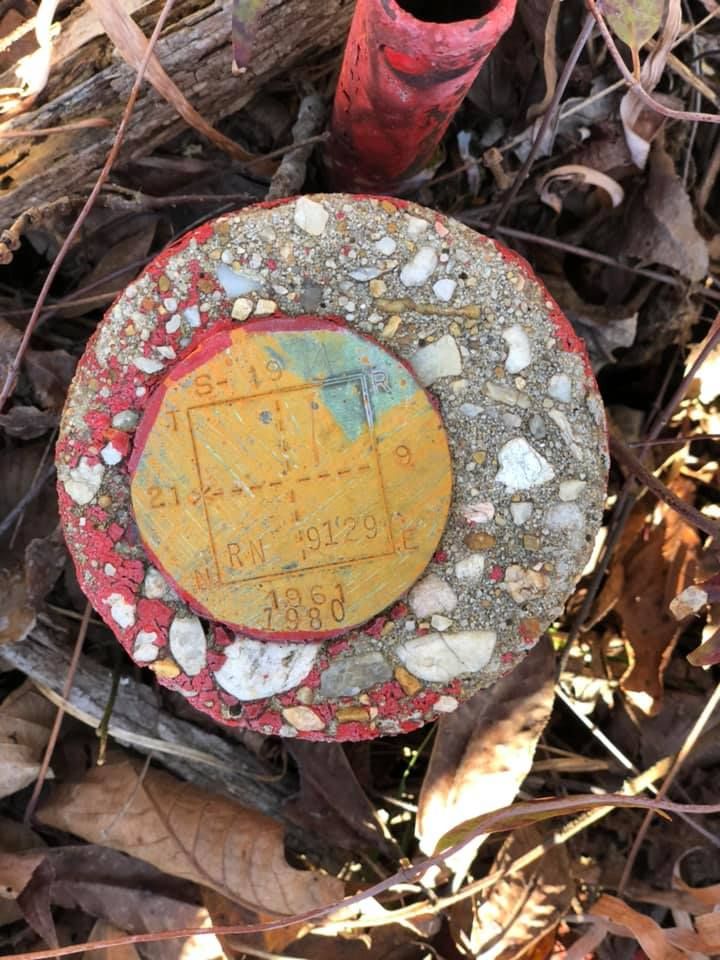
Left picture: see the dates on the bottom of the disc. The lighter knot you see a couple of feet south was established in 1961; the disc was re-established in 1980 by the Government. National Forest land in Perry County, Alabama – a fractional section on the range line.
Retracing a boundary like this means following more than half a century of evidence: the original pine-knot corner, the government brass disc set later, and the records that tie them together. Finding and verifying both is what lets a surveyor hold the corner with confidence.
More work
Other recent jobs
Need a survey like this?
Call or text Randy – you will talk directly to a licensed land surveyor.