Land surveyor · Selma, AL
Land surveying in Selma, AL
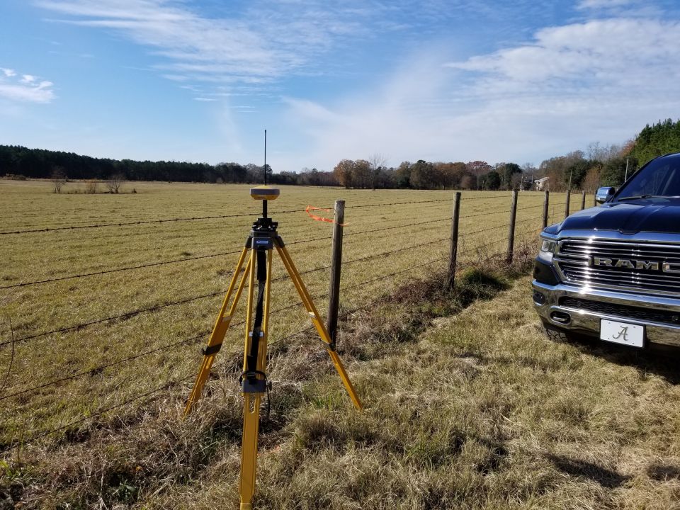
Land surveying for Selma and Dallas County – subdivision and construction staking, boundary surveys of farm and timber land, and FEMA elevation certificates along the Alabama River.
Dallascounty
~38miles from our Clanton office
1projects on this page
PLSlicensed land surveyor
Surveying in Selma and the Black Belt
Selma, the seat of Dallas County, sits on a bluff above the Alabama River in the heart of the Black Belt. Outside the city, the land is mostly farms, pastures and timber tracts – large parcels with long lines and old corners, where a careful boundary survey or resurvey is often the first step before a sale, a timber harvest or a division among heirs.
Building near the Alabama River
In December 2018 we staked a new subdivision on the Alabama River in Selma. Near the river, elevations matter as much as lines: FEMA flood zones decide where homes can sit and what flood insurance will cost. A topographic survey helps the engineer lay out lots and streets, and an elevation certificate documents each new home’s lowest floor.
National forest and timber land nearby
Our work in the region reaches into neighboring Perry County as well, where we retraced a national forest boundary corner first set in 1961 and re-established by the Government in 1980. Recovering original evidence like that is what makes a rural survey hold up.
Deeds and plats for Selma properties are recorded with the Dallas County Probate Office – where our research for every survey here begins.
Our work
Our projects in and around Selma
Services
Surveying services in Selma
- Boundary SurveyWe determine your property lines and corners exactly as described in your deed.
- Topographic SurveysElevations, contours and features – the starting point for engineers and architects.
- ALTA SurveysDetailed ALTA/NSPS land title surveys for commercial purchases, lenders and title companies.
- FEMA Elevation CertificateKnow your flood risk, challenge a flood zone or lower your flood insurance premium.
- Construction LayoutWe interpret architectural or engineering plans and stake the location and elevation of new structures.
- As-Built SurveyDocuments what was actually built – during construction and for the Certificate of Occupancy.
- Foundation SurveysConfirms the foundation was poured correctly and sits in the right position and location.
- House Corner StakingEvery corner of your new building staked exactly where the site plan puts it – before work begins.
- Property Line StakingYour property lines marked in the field with stakes and flags – before the fence goes up.
- Site PlanA site plan for your building permit – lot, setbacks, easements and the proposed house, drawn to scale.
- ResurveyOld surveys were made without GPS or robotics – a resurvey brings your lines up to date.
JJavetta Lodge
Randy was quick and efficient. Even when he had to make a 2nd trip (becaue I didn't communicate correctly, lol) he did so. He gave me a fair price and they allowed me to communicate through text ..which I preferred. I highly recommend them!
KKyle Lubsen
Randy with Alabama Surveying and Mapping was great to work with! As a Realtor I deal with surveys and surveyors all the time and I was impressed with how responsive he was to all the questions we had. We needed a unique property surveyed and split into two parcels and he did a great job very quickly, when no one else could, and got it done exactly how my client wanted! He's got our business and you should give him…
PPaige Ray
I am a Realtor and was frantically searching for surveyor near Clanton, AL on a Monday afternoon. The lender needed a survey asap and closing was set for Friday! I spoke with Randy Phillips with Alabama Surveying and Mapping; he was very understanding and professional. He went out of his way to help us with this issue. He was at the subject home by Tues morning in the rain and had the report to us by mid day!!! His…
CChris Willis
Great experience. I deal with residential surveyors on a regular basis, but when I purchased a tract of land, Randy was recommended by the bank, and turned out to be very responsive, was able to do the job on a very tight schedule, and for a very reasonable price. I highly recommend him for any surveying you need.
PPamela Martin
Randy Phillips went over and beyond to survey my land in Jefferson County! Awesome company that is reliable, professional, and dependable. Any issues were quickly and professionally resolved. I highly recommend him and his company for any survey needs.
SShane Odom
Randy is very professional and has a great response time. I have been doing business with Randy for awhile and he drives all over Alabama to get the job done on time and correct. If any one needs surveyor done professionally and timely I recommend Randy at Alabama Survey and Mapping!!!! Shane Odom MarMac Real Estate
Questions & answers
Surveying questions from Selma
Do you survey farm and timber land around Selma?
Yes. Large rural tracts are a big part of our work – we research the deeds, recover the old corners and set new monuments where needed.
Is my Selma property in a flood zone?
FEMA flood maps show it; if your lender says it is, an elevation certificate shows how high your building actually sits and can help you challenge the zone or lower the premium.
Do you stake subdivisions?
Yes – lots, streets and utilities, as we did for a new subdivision on the Alabama River in Selma.
Nearby towns we serve
Contact
Get a quote for your Selma property
When you call, you talk directly to a qualified land surveyor.
- Call or text Randy(205) 688-6656
- E-mailrandy@alabamamapping.com
- Office hoursMon–Fri 9:00 AM – 5:00 PM